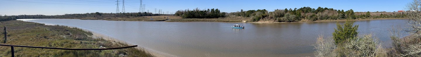
Hydrographic Surveying Services
Measuring and mapping navigable and non-navigable water bodies and accompanying shorelines and beaches is an essential part of our hydrographic surveying services. We understand that life does not stop at the shoreline and our clients often need to know the location and condition of their assets in and around water bodies of all sizes.
Our trained experts providing hydrographic surveying services have the surveying and mapping tools necessary to locate and map submerged obstructions, prepare for underwater construction, monitor coastline erosion, provide data for hurricane recovery programs, measure depths, and compute volumes for dredging projects. Our hydrographic surveying services also routinely include pipeline route surveys, depth of cover surveys, and rehabilitative program support from our survey vessels.


Multibeam Sonar Hydrographic Surveying
The advantages offered by our multibeam sonar hydrographic surveying services are impressive. Similar to a single-beam device, multibeam sonar surveying equipment allows for fan-shaped coverage of the ocean floor, but with substantially more detail captured in the process. Multi-beam hydrographic surveying systems measure the time that each signal takes to travel from the device to the seafloor and return again. By measuring the time, the distance to the seafloor can be calculated, and by knowing the angle at which the signal was sent from the device, the depth can be calculated.
When you put that tremendous amount of data together, a realistic three-dimensional representation of the seafloor can be created, giving a much greater degree of accuracy to the resulting data and imaging. Blind spots can be eliminated, and hazards can be identified and avoided.
With the multibeam sonar hydrographic surveying equipment and experienced technicians, Whiteley Infrastructure Group's survey time is shortened to save you valuable time and money.
As a result, hydrographic surveying projects that depend on accurate seafloor imagery, such as locating a pipeline in need of repair or maintenance, can become substantially more efficient. Dredging operations can be planned for maximum efficacy and profitability.
Hydrographic Surveying & GIS Mapping
The vast array of hydrographic surveying data makes it a perfect application of GIS technology. Whiteley Infrastructure Group is your go-to team for creating hydrographic surveying databases and representing data in various layers to create the specific models needed for particular applications.
When you need to work with a partner who understands hydrographic pipeline surveying services from concept to completed application from the perspective of the customer, you’re looking for the professionals at Whiteley Infrastructure Group. Contact us today to get started with your project.
Services Offered
- Marine Construction
- Navigable Waterway Surveys
- Non-Navigable Waterway Surveys
- Depth of Cover Survey
- Offshore Mapping
- Dredging Inspection
- Coastal Erosion
- Singlebeam
- Multibeam
- Bathymetric Charts
More Services
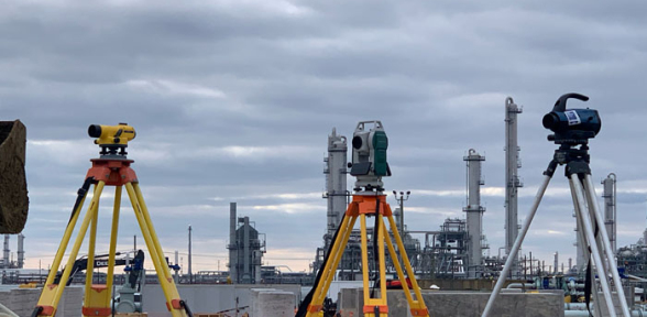
Whiteley Infrastructure Group has the expertise and experience to provide safe, accurate, and reliable results every time, on time, and on budget. We have been surveying for over 65 years and we understand what it takes to deliver accurate survey information to our clients.
Our World-Class Clients
We are proud to partner with some of the most productive, most respected, and world-renown companies in the U.S. Our work in surveying, engineering, GIS, and more have served successful projects far and wide with names such as these.

Industries Served
Veteran-led and family-owned, Whiteley Infrastructure Group provides full spectrum surveying services for clients in a wide range of applications.
Oil & Gas Pipelines
Petrochemical & Refining
Power Generation
Renewable Energy
Public Utilities
Land Use
Areas Served
Whiteley Infrastructure Group operates across the United States. We are well equipped to respond quickly to our clients’ needs wherever they may arise.

About Us
Whiteley Infrastructure Group provides civil engineering and land surveying services to the energy, petrochemical and real estate market. Whiteley Infrastructure Group is uniquely positioned to support the growth and development needs of our clients.
Contact Us
Professional Engineer Firm #: F-2633
Registered Professional Land Surveying Firm #: 10106700
Beaumont, TX 77707